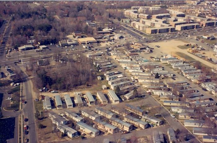
Aerial view of Lower Alexandria, in early 1980 April 1, 2015October 13, 2015Aletha Golas This aerial photo from 1980 depicts the intersection of Frye Road and Rt 1 (Richmond Highway). It's amazing how much this area has changed. Compare this to a Google satellite image from today. Frye Rd & Richmond Highway