Virginia lawmakers are fighting against “drive-by foreclosures,” saying the foreclosure process in the state is one of the fastest in the nation and needs to be slower and have judicial review.
Bills in the Virginia House and Senate will set out to slow the state’s fast foreclosure pace by increasing the time required for foreclosure notice from two weeks to 30 or 45 days. The goal is to give borrowers more time to challenge the foreclosure if needed.
"We simply don't have enough time to stop a foreclosure because of the fact that it's in 10 days or seven days," Todd Condren, a title insurance lawyer from Vienna, Va., told the House Courts of Justice Committee.
The bills also set out to require lenders to face court review before foreclosing on home owners. Lenders will also be subjected to fines if it's found that any foreclosure was based on fraudulent documents or documents that contained any errors. The proposed bills also will have a requirement that lenders maintain updated real estate loan records in county courthouses and give borrowers an opportunity to avert foreclosure by paying off any delinquency.
Virginia’s banking lobby officials argue that slowing foreclosures and requiring updated county land record filings would just prolong the already four year housing slump.
Source: “Bill Seek Judicial Review of Foreclosures in Va., Better Mortgage Ownership Records,” The Associated Press (Jan. 17, 2011)
Located north of Manassas in Prince William County, the Manassas National Battlefield Park sites the area where the American Civil War battles took place in July 21, 1861 ( First Battle of Bull Run) and in August 28 and 30, 1862 ( Second Battle of Bull Run – First Battle of Manassas).
The National Battlefield Park was established in 1940 and listed on the National Register of Historic Places in October 15, 1966, that now offers everyone the chance to discover the site where the battles took place years ago along with the Henry Visitor Center located at the south entrance to the park that showcases the civil war era uniforms, weapons, gear, exhibits and more to highlight the First Battle of Bull Run.
Featured at Manassas National Battlefield Park:
Stone House – Found at the intersection of Sudley Road and Lee Highway that was occupied as a hospital during the battles.
Stone Bridge – Located on Lee Highway and within proximity of Bull Run where the Union retreated after the battles.
Brawner’s Farm – Location where the second battle began and renovated as a museum exhibiting the Second Battle of Bull Run.
Battery Heights – The Confederate batteries were deployed at the Union troops.
Matthews Hill – Site where the first battle begun.
The Unfinished Railroad Grade – Site where Jackson deployed his men for the second battle.
The Deep Cut – Area where Pope fired his attacks against the Grade.
Groveton – A Civil War era neighborhood with remains of a small house that was occupied by Lucinda Dogan with a Confederate Cemetry nearby.
New York Monuments – Site where 123 5th New York Zouaves men lost in 5 minutes.
Hazel Plain – Chinn family plantation now in ruins located across the Henry Hill Visitors Center.
Chinn Ridge – Counterattack of General James Longstreet of the second battle took place.
Portici – Francis Lewis plantation used as the Confederate Headquarters in the second battle now in ruins.
The Robinsons House – The home of James Robinson.
Manassas National Battlefield
12521 Lee Highway
Manassas, VA 20109
Doeg Indians Marker at the pull off area along VA 235
A tribe of Native American Indians called the ‘Doeg’ or ‘Doages’, ‘Dogues’, ‘Taux’, Dogi’, ‘Tacci’ and more had resided in villages of Northern Virginia along the Potomac River and Occoquan Rivers, including Tauxenent near the mouth of the Occoquan River, Assameck near Alexandria and Namasingakent near Mount Vernon in 1607. The ‘Doeg’ were said to be a branch of the Algonquian language family who lived on hunting, fishing and farming according to the seasons while frequently residing in different locations.
A large number of the ‘Doeg’ were forced out by the English colonists within the 17th Century while the others died from European diseases. The remaining ‘Doeg’ moved towards the eastern bank of the Potomac River and south of the north bank of the Rappahanock.
The Dogue Creek is named after the ‘Doeg’ Indians.
The Federal Highway Administration (FHWA) is a part of the U.S. Department of Transportation and is headquartered in Washington, D.C., with field offices across the United States. One of these offices is a a federally owned and operated research facility in McLean, Virginia named the Turner-Fairbank Highway Research Center. The Turner-Fairbank Highway Research Center (TFHRC) isTFHRC is the home of the Federal Highway Administration's (FHWA's) Office of Research, Development, and Technology.
TFHRC provides Federal Highway Administration and the world highway community with the most advanced research and development related to new highway technologies. The research focuses on providing solutions to complex technical problems through the development of more economical, environmentally sensitive designs; more efficient, quality controlled constructions practices; and more durable materials. The expertise of TFHRC scientists and engineers encompasses more than 100 transportation-related disciplines that are put to use in the research laboratories housed at TFHRC. These laboratories provide a vital resource for advancing the body of knowledge that has been created and developed by our researchers. The end result is a safer, more reliable highway transportation system.
The Turner-Fairbank Highway Research Center (TFHRC) is located at 6300 Georgetown Pike in McLean, VA22101. If you're looking for a home in close proximity to TFHRC you might want to check in Langley.
“Zero-loss” of remaining County-owned natural lands
248 County-owned acres identified for preservation
Three-year inventory found seven unmapped streams, 600 native species, including 14 rare plants
ARLINGTON, VA – The Arlington County Board today approved the County’s first comprehensive plan to preserve and manage County-owned natural lands.
“By adopting this plan today, we are taking much-needed action to protect our remaining open spaces, and the plants and animals they shelter, for future generations,” County Board Chairman Jay Fisette said. “Our parks department has done an outstanding job of comprehensively mapping this County’s natural resources and giving us the information we need to preserve Arlington’s natural resource assets.”
The plan is based on an unusual, comprehensive inventory of Arlington’s natural resources carried out between 2005 and 2008 by the County Department of Parks, Recreation and Cultural Resources. The inventory found that only 4.7 percent of Arlington’s surface area — a little more than 700 acres — remains as natural lands. Of these, well over half are owned by the U.S. Park Service as part of the George Washington Memorial Parkway system. Fifty percent of all surface streams have disappeared and invasive plant species are widespread. (View presentation to the PDF, 2MB)
Highlights of the plan’s 19 recommendations for preserving and managing natural lands include:
Adopting a general policy goal of “zero-loss” of County-owned natural lands.
Developing a new GIS-based environmental review process to protect significant individual natural resources on County-owned open space.
Establishing a single, specialized management unit to manage Arlington’s natural resources.
Establishing a new administrative category of County-owned open space, or Natural Resource Conservation Areas (NRCA).
Developing an individual natural resources management plan for each County-owned park designated as a Natural Resource Conservation Area, or containing NRCAs.
The Board voted 5-0 to approve the plan.
To read more about the plan, visit the County’s website.
Arlington, Va., is a world-class residential, business and tourist location that was originally part of the "10 miles square" parcel of land surveyed in 1791 to be the Nation's Capital. It is the geographically smallest self-governing county in the United States, occupying slightly less than 26 square miles. Arlington maintains a rich variety of stable neighborhoods, quality schools and enlightened land use, and received the Environmental Protection Agency's highest award for "Smart Growth" in 2002. Home to some of the most influential organizations in the world - including the Pentagon - Arlington stands out as one of America's preeminent places to live, visit and do business.
Fresh-cut flowers at Farmer's Market at Sherwood Hall Library
Opened in 1971 and located at 2501 Sherwood Hall Lane in Alexandria, the Sherwood Regional Library provides many resources and services for residents, including hands-on technology classes, one-on-one tutoring sessions, 27 internet stations with Microsoft Office Suite and a computer with ZoomText software.
For those hosting community meetings or gatherings, the library has numerous spaces, including a meeting room that fits 200 and is often used for family literacy classes. Other spaces are four conference rooms for 12-45 people each, a group study room for four people and a quiet study room for 10. The library also hosts the Mt. Vernon Farmers Markets on Tuesday mornings from May to November and an ongoing book sale. For more information on library events, click here.
In addition, visitors can bring their laptop and use the wireless internet or bring children to use the Read to Me Room with puzzles, flannel boards and board books. For more information about the library and its services, click here or call 703-765-3645.
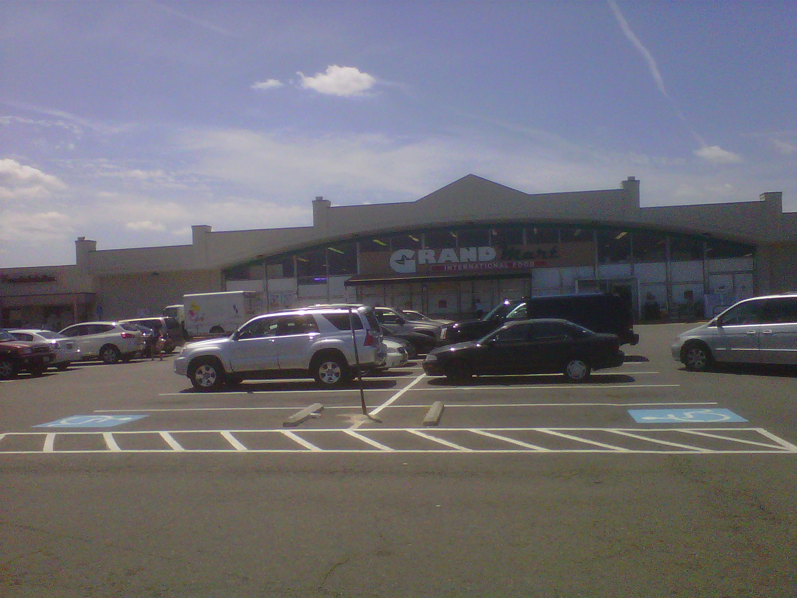
Grand Mart at Lincolnia in West End Alexandria
Grand Mart International Food is a supermarket chain primarily based in the Washington, D.C. metropolitan area, with locations in North Carolina and Georgia. It is owned by Annandale, Virginia-based Man Min Corporation, a family company. My wife shops there from time to time and she loves the wide selection of Korean and East Asian groceries and fresh produce.
The store in Lincolnia is somewhat international offering Asian, Latino, African and traditional North American groceries, but Grand Mart caters to Korean cooks and grocery preferences. Grand Mart supermarkets also offer in-store Korean bakeries and video rental shops which rent out DVDs of television shows from South Korea.
The Federal Deposit Insurance Corporation (FDIC) is an independent agency created by the Congress to maintain stability and public confidence in the nation's financial system by:
insuring deposits,
examining and supervising financial institutions for safety and soundness and consumer protection, and
managing receiverships.
The FDIC is located near Virginia Square Metro and is located at 3501 Fairfax Dr, Arlington VA.