Northern Virginia's traffic is shaped by its proximity to Washington DC and proximity to several important job centers. The world famous Capitol Beltway (Interstate 495) circles DC like a wheel around a hub. The Beltway links Northern Virginia's suburban communities such as Springfield, Kingstowne, Braddock Road and Vienna to the transportation network. The Beltway generally moves at or above the speed limit most times and most days.
In Virginia, the Beltway travels from the American Legion Bridge upriver to the newly-rebuilt Woodrow Wilson Bridge downriver. At each bridge the Beltway enters Maryland. In Maryland the Beltway loops around DC creating a complete route.
Nesbitt Realty is a real estate brokerage serving Tysons Corner VA
There are several important job centers along 495, such as Tysons Corner. Tysons Corner is poorly served by mass transit and there are regularly scheduled traffic jams at Tysons every rush hour. In addition, the bridges are choke-points for traffic entering and leaving Virginia at the American Legion Bridge and at the recently re-built Woodrow Wilson Bridge.
Traffic into Maryland at the Woodrow Wilson Bridge favors Virginia commuters heading into Maryland. Commuters from Virginia generally won't have much trouble reaching Andrews AFB, the Census Bureau, etc. Conversely, the evening approach to the Woodrow Wilson Bridge backs up with Maryland residents heading home from jos in Virginia. This problem should soon be alleviated greatly as the new bridge comes completely online.
The American Legion Bridge serves many Virginia commuters headed for Rockville, Silver Spring, etc. This burden, coupled with its proximity to Tysons Corner causes the Beltway to slow during rush hour.
The Beltway loops around DC like a wheel around a hub. Many roads and rails in the area link to DC like spokes on that wheel. There are many of these spokes, but in Virginia there are three primary corridors from DC: I-66, I-395, and US 1 together with the GW Parkway.
66 Corridor and Orange Line
I-66 is HOV only during rush hour, but other routes (such as 50, 29 & 28) parallel the interstate as it approaches DC. Taken as a whole this road system can carry a tremendous amount of traffic, but it slows considerably during rush hour.
Interstate 66 is a major commuter route in Northern VA
The 66 corridor is also served by the Orange Line, with Metro stops in Arlington at Rosslyn, Clarendon, Ballston (and more). The Orange Line continues through West Falls Church and then into Fairfax County with a terminal station at Vienna. 66 is used by commuters in Fairfax, Centreville, Manassas and beyond to the hinterlands.
In addition to the routes mentioned above, outside the Beltway 66 is supported by the Dulles Tollroad, which links the area to Dulles Airport and outlying suburbs such as Herndon, Reston and beyond.
I-395
Interstate 395 doesn't have a Metro train service but it carries a massive load of traffic none-the-less. In addition to its 8 to 10 lanes of traffic, 395 has an extra 3 lanes of HOV that switch direction depending on the hour of the day. 395 leaves DC between the Pentagon and Crystal City (both in Arlington) and on the way out to I-95 and the Beltway at Springfield, I 395 passes Shirlington, Landmark, East Falls Church and other neighborhoods.
Traffic on 395 is nearly always heavy but only slows during rush hour.
George Washington Parkway, Rt. 1 and the Yellow & Blue Lines
North of the Key Bridge, the 4 to 6 lanes of the George Washington Parkway ties into I-495 at the American Legion Bridge. This route serves Mclean and Northern Arlington County. South of Memorial Bridge, the George Washington Parkway and US Rt. 1 together only carry 8 to 10 lanes of traffic.
Huntington Metro Yellow line at the lower level
Traffic here is relatively light considering the proximity to the city, and the fact that US 1 has several traffic lights. This route follows the Potomac downriver toward the Beltway at the Woodrow Wilson Bridge.
This route is also supported by the Yellow and Blue Metro Lines. Taken as a whole, this route serves commuters at Crystal City, Pentagon City, Del Ray, Old Town, New Alexandria and Mt. Vernon to the city. At King St, the Yellow and Blue Lines fork with the Yellow Line continuing toward Mt. Vernon, but ending at Huntington. The Blue Line turns south toward Springfield with stops at Van Dorn and Springfield.
The Arlington National Cemetery is recognized around the country and around the world, but nearby is a similar treasure from our nation's heritage: the Alexandria National Cemetery.
The Alexandria National Cemetery is located in the City of Alexandria VA
Arlington National Cemetery was featured in Gardens of Stone and numerous other feature films. This has no doubt added to Arlington's mystique and celebrity. Arlington Cemetery was carved from the farm of Robert E. Lee, a native of Alexandria. This is one of many connections between Arlington and Alexandria National Cemeteries.
The five acres of Alexandria National Cemetery are tiny compared to Arlington's 612 acres. Newcomers and those who don't know the history of the area may be surprised to learn that while Alexandria was a colonial era settlement, Arlington is a relatively new creation. (Check out Alexandria's best real estate deal ever!)
Alexandria National Cemetery predates the cemetery in Arlington and is in some ways the reason for Arlington's existence. Alexandria National Cemetery was established during the Civil War in 1862 as one of the original 14 national cemeteries.
The first four acres of Alexandria National Cemetery were purchased by the US government from what was to be Spring Garden Farm. By 1870, the United States purchased additional land to bring the cemetery up to its current size.
The first burials made in Alexandria National Cemetery were soldiers who died during training for the Civil War. Additionally, some casualties were sick or diseased soldiers from one of the numerous hospitals around Alexandria. The death and destruction wrought by the Civil War exceeded all expectations. It was evident that Alexandria National Cemetery would be woefully short of the needs imposed by the War. By 1864, Alexandria National Cemetery was nearly filled to capacity. In large part, the shortage of space in Alexandria led to the planning, development and construction of Arlington National Cemetery.
After the Civil War, improvements were made to the design of Alexandria National Cemetery and by 1871 the cemetery had added a fountain, a cobblestone avenue and graveled walkways. A wrought-iron rostrum, a small pond and a greenhouse were added as well. The primary building on grounds is a brownstone structure---the superintendent’s lodge. The lodge dating to 1870 is the oldest surviving building on the grounds. The lodge is constructed in a style and with materials popular from the era and perhaps best recognized in the the Smithsonian Institution's "Castle," and the U.S. Capitol floor and rotunda door frames.
Many of the graves at Alexandria National Cemetery date to the Civil War era
Like other national cemeteries, the Alexandria National Cemetery featured a "comfort station" built in 1887. This building is one of only a few such structures to survive to the present day. In 1927, the station significantly altered by adding a dining room and converting the facility into a kitchen/store room and tool-shed/toilet. The entire cemetery is surrounded by a wall of Seneca sandstone with River Blue Stone coping. (This is the same material used to build the superintendent's lodge.) Visitors gain entry by passing through a 12-foot wide ornamental cast-iron gate at the Wilkes Street entrance.
In the 1930's the flagpole was added and in 1995 the cemetery was added to the National Register of Historic places. There is no grave locator or kiosk on the grounds and the cemetery only has room for cremated remains and certain relatives of persons already buried at Alexandria National Cemetery.
Among other notable persons buried at the Alexandria National Cemetery are several "Buffalo Soldiers"---a nickname for several Cavalry Regiments of the US Army. Several African-American regiments of Buffalo Soldiers were formed during the Civil War to fight alongside the Union Army. Among these were the famed 54th Massachusetts Volunteer Infantry and many United States Colored Troops Regiments. After the Civil War, the Buffalo Soldiers were established by Congress as the first peacetime all-black regiments in the regular U.S. Army. It is fitting that these soldiers are buried near Alexandria's African American Heritage Park.
Together with the African American Heritage Park the Alexandria National Cemetery makes up the eastern boundary of the Carlyle District.
Nothern Virginia Condo Experts
3899 Brighton Ct.
Alexandria, VA, 22305
If you have questions about condo documents, insurance or maintenance, contact the office above.
If you would like to purchase a condo, give us a call at Condo Alexandria.
Creative Commons License photo credit: CrimsonMage
The Potomac River is located on the east coast of the United States, and runs through Maryland, Virginia, West Virginia, and Washington, D.C. before it empties into the Chesapeake Bay. It is over 380 miles long and wider than 11 miles at its widest point.
As it passes through Washington DC, the nation's capital, the Potomac passes the Washington Monument and the memorials of Jefferson, and Lincoln. Many consider the Potomac to be one of the most beautiful and bountiful rivers on the East Coast. The river is also widely regard its historic, scenic and recreational significance. Among the many who loved the Potomac was George Washington, who worked as a surveyor at many points along the banks of the river. George Washington's mansion
at Mount Vernon is on the Potomac.
Mount Vernon, George Washington's estate on the Potomac
The Potomac's source is a small spring at the Fairfax Stone in West Virginia. From there, the river gathers many tributaries, winding through the mountains and valleys of Appalachia. One of its most
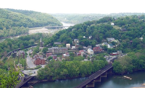
dramatic turns occurs at Harper's Ferry where the Shenandoah meets the
Potomac.
At Great Falls, the Potomac tumbles down from the Appalachian Highlands to the sandy soils of the Atlantic Coastal Plain. Visitors from the colonial era to the modern era relish the views here. Today visitors at Great Falls
will not only marvel at the cataracts, but also the engineering efforts of those who sought to fulfill George Washington's dream of connecting the Chesapeake Bay to the Ohio River. The C & O Canal was only operational for a few short years, but remnants of the system are still functional at Great Falls Park.
Finally, the river flows almost 400 miles widening to over 11 miles as it reaches the Chesapeake Bay on the long, low, and barren peninsula named Point Lookout, Maryland. Before the US Civil War, Point Lookout was home to a few hotels and boarding houses, but during the war it was converted into one of the largest and worst of the Union
prisoner-of-war camps.
Fishers, anglers, boaters, sailors and kayakers all enjoy the Potomac.
The Potomac River has a watershed of 14,670 square miles including tributaries in Maryland (the Monocacy, Savage, and St. Mary's Rivers); in Virginia (the Shenandoah and Occoquan Rivers); in West Virginia (the South Branch and Cacapon Rivers); in Pennsylvania (Conococheague and Antietam Creeks); and in Washington DC (the Anacostia River). The Potomac cradles forests, battlefields, farmlands, mountains, parks, and cities. It is known to many as our Nation's River.
If you're searching for a home or condo in Northern Virginia with a view of the Potomac, contact Will Nesbitt with Condo Alexandria.
The feeling of space is the first thing that hits you when you visit Mount Vernon Grove. The large homes in this area have lots of green space, which makes for wonderful gardens and plenty of room for the kids. The houses were built in the 1970's, in a classic colonial style, but over the years have been upgraded. Many include features such as garages, attractive flooring and some appliances.
Mount Vernon Grove is situated a short distance from the Old Mount Vernon road, nestled in a beautiful part of Fairfax County.
Established in 1974 with a mission to reduce homelessness, increase community support and promote self sufficiency, the Good Shepherd Housing and Family Services is operated by a multi-denominational board of directors and staff managing over 70 housing units. Good Shepherd Housing and Family Services is located in the Mount Zephyr Business Center at 8305 Richmond…
Tower at Reagan National Airport
Ronald Reagan Washington National Airport, formerly Washington National Airport, is on the Potomac across the river from Washington DC. Along with Baltimore Washington International and Dulles International, Reagan National is one of three major airports serving the Washington Metro area. Reagan National is easily my favorite of the three airports for a number of reasons.
Dulles and BWI are massive sprawling airports with shuttle buses and mobile lounges. Reagan National barely has enough room for the runway. I always like smaller airports. They feel like they are scaled to human beings. There is plenty of security at National, but it seems to move along more smoothly than Dulles or BWI.
Dulles and BWI are outside the Beltway at the periphery of the Washington Capitol Area. Reagan National is at the heart of everything, wedged at the confluence of DC, Alexandria and Arlington. For me, it's a long drive just to get to BWI or Dulles, but Reagan National is here, and it's accessible by Metro. Reagan National is a
station on both the Yellow and Blue lines.
Main concourse of Reagan National Airport
Extended parking is available at Dulles or BWI, but on the shuttle bus, the ride from the parking lot to the terminal seems like a mile or more. At Reagan National, extended parking is at my house. Because instead of taking a shuttle, I can take the Metro to the airport.The runway is a short at Reagan National and it launches planes up over GW Parkway and at the Washington Monument, requiring a steep climb and a hard left on take off. Some folks find this terrifying, but I have to admit I love it. I know it's a safe path, because planes take-off here day and night, so I sit back and enjoy the abrupt take-off and turn.
Reagan National is open 24 hours a day 7 days a week, although many ticket counters and restaurants in the airport close during off-hours. Reagan National is located within the Commonwealth of Virginia, but it has a Washington DC address to identify the airport's location more easily for travelers.
The Perimeter Rule and the High Density Rule affect flights at Reagan National. Under the Perimeter Rule, nonstop aircraft flights are limited to a range of 1,250 miles or less. In 2000, Congress permitted the FAA to allow six round-trip flights to points outside the perimeter. The High Density Rule (or "Slot" rule) limits the number of landings or takeoffs allowed in an hour. The rule affects Reagan National because of the Airport's limited airfield capacity.
Reagan National is located in Arlington County near/in Crystal City. It is most easily accessed from the George Washington Parkway. There are a good many condos and homes in the Crystal City area and they're all just a metro stop away from Reagan National. The take-off and approach to Reagan National is down the Potomac, so that area residents get very little noise or fly-over from the jets at Reagan National.
Fort Meyer Heights lies at the southern side of Rosslyn, along Fort Meyer and toward Arlington National Cemetery. Fort Meyer Heights is behind the Iwo Jima Memorial toward Clarendon.
But, Fort Myer Heights is just one of many communities close to military bases which Nesbitt Realty serves. For more information about homes near the base you serve, check out:
Established in 1974 with a mission to reduce homelessness, increase community support and promote self sufficiency, the Good Shepherd Housing and Family Services is operated by a multi-denominational board of directors and staff managing over 70 housing units. Good Shepherd Housing and Family Services is located in the Mount Zephyr Business Center at 8305 Richmond…
Northern Virginia has several independent cities and the City of Alexandria is one such independent city. The City of Alexandria borders Fairfax County, but the City of Alexandria is not in Fairfax County. Fairfax County is not in the City of Alexandria. However, there are large parts of Fairfax County that have an Alexandria postal address. The Alexandria area which is outside of the City of Alexandria can be roughly categorized into the following areas:
For real estate in Alexandria VA contact Nesbitt Realty
Lower Alexandria — so-called because the area south of Old Town Alexandria is downriver from Alexandria. (Lower Alexandria is sometimes called “South Alexandria”.) Lower Alexandria includes the Fairfax County Districts of Mount Vernon and Lee.
Franconia — Franconia is mostly in Lee District. Some residents of Franconia have a Franconia address but many homes in Franconia have an Alexandria address. Rose Hill is one of many communities in and around Franconia
Alexandria West — Not to be confused with West End Alexandria (which is in the City of Alexandria), Alexandria West includes many inside the Beltway but outside the City of Alexandria residences such as the homes of Bryn Mar.
Here's an interest local tidbit for newcomers. Fairfax County surrounds the City of Fairfax. Locals generally refer to the county as “Fairfax County” and the city as “Fairfax”, but Alexandria uses the opposite nomenclature. “Alexandria” generally refers to whole of the Alexandria area, while “City of Alexandria” refers to the jurisdiction of the City of Alexandria.
King Street Metro Station
“Location, location, location near public transportation” may be the new real-estate mantra according to a new study released today by the American Public Transportation Association and the National Association of REALTORS®. Data in the study reveals that during the last recession, residential property values performed 42 percent better on average if they were located near public transportation with high-frequency service.
“When homes are located near public transportation, it is the equivalent of creating housing as desirable as beachfront property,” APTA President and CEO Michael Melaniphy said. “This study shows that consumers are choosing neighborhoods with high-frequency public transportation because it provides access to up to five times as many jobs per square mile as compared to other areas in a given region. Other attractive amenities in these neighborhoods include lower transportation costs, walkable areas, and robust transportation choices.”
“Higher home values reflect greater market demand for areas near public transportation,” said NAR Chief Economist Lawrence Yun. “Transportation plays an important role in real estate and housing decisions, and the data suggests that residential real-estate near public transit will remain attractive to buyers going forward. A sound transportation system not only benefits individual property owners, but also creates the foundation for a community’s long-term economic wellbeing.”
The study, The New Real-Estate Mantra: Location near Public Transportation, investigates how well residential properties located in a half-mile proximity to high-frequency public transportation or in the “public transit shed” have performed in holding their value during the recession compared to other properties in a given region.
While residential property values declined substantially between 2006 to 2011, properties close to public transit showed significantly stronger resiliency. In Boston, residential property in the rapid-transit area outperformed other properties in the region by 129 percent. In the Chicago public transit-area, home values performed 30 percent higher than other homes the region; in San Francisco, 37 percent higher; Minneapolis-St Paul, 48 percent; and in Phoenix, 37 percent.
“Stable property values in areas with public transit access have a number of policy implications,” Melaniphy said. “As Congress and state and local governments look for ways to accelerate economic growth, this study shows that investing in public transportation is a boon to revitalizing our economy.”
“When consumers choose a home, they also choose a lifestyle. Shorter commutes and more walkable neighborhoods matter to a growing number of people, especially those living in congested metro areas,” Yun said.
Source: NAR
Julie Nesbitt
Julie Nesbitt knows the back trails and by-ways of Northern Virginia real estate.
Established in 1974 with a mission to reduce homelessness, increase community support and promote self sufficiency, the Good Shepherd Housing and Family Services is operated by a multi-denominational board of directors and staff managing over 70 housing units. Good Shepherd Housing and Family Services is located in the Mount Zephyr Business Center at 8305 Richmond…
Home prices are rising, the number of homes for-sale is showing a slight increase, and homes are selling faster—all signs that spring is in the air in real estate, according to the latest MLS data released by Realtor.com®.
Nationwide, median list prices continue to tick up, reaching $189,900 in February. Inventories last month increased 1.15 percent month-over-month, after recently hitting record lows. Also, homes are selling faster with the median age of inventory at 98 days, a 9.26 percent drop from the previous month.
“As we enter the busiest time of the year for home buyers and sellers, our latest housing trend data shows just how competitive the market is with a significant housing recovery well underway,” says Steve Berkowitz, chief executive officer of Move Inc. “Looking ahead, we can expect the amount of inventory to increase this spring along with higher list prices as sellers become more comfortable with the market conditions.”
Median list prices were up 5 percent or more in 51 markets on a year-over-year basis, according to realtor.com®. California markets are seeing some of the highest increases in list prices as well as some of the largest declines in for-sale inventory. Other top performing markets include Phoenix, Seattle, and Denver, according to realtor.com®.
“However, many smaller industrialized markets in the Midwest and the Northeast registered year-over-year price declines, as did Philadelphia, Chicago, and New York City,” Lexie Puckett reports in a recent realtor.com® blog post. “While the number of markets experiencing year-over-year list price declines had been increasing, this pattern appears to be turning around as home list prices increased in 78 markets last month on a year-over-year basis and declined in 39.”
Source: “Spring Home Buying Season Starts Early According to Realtor.com’s February Trend Data,” RISMedia (March 18, 2013)